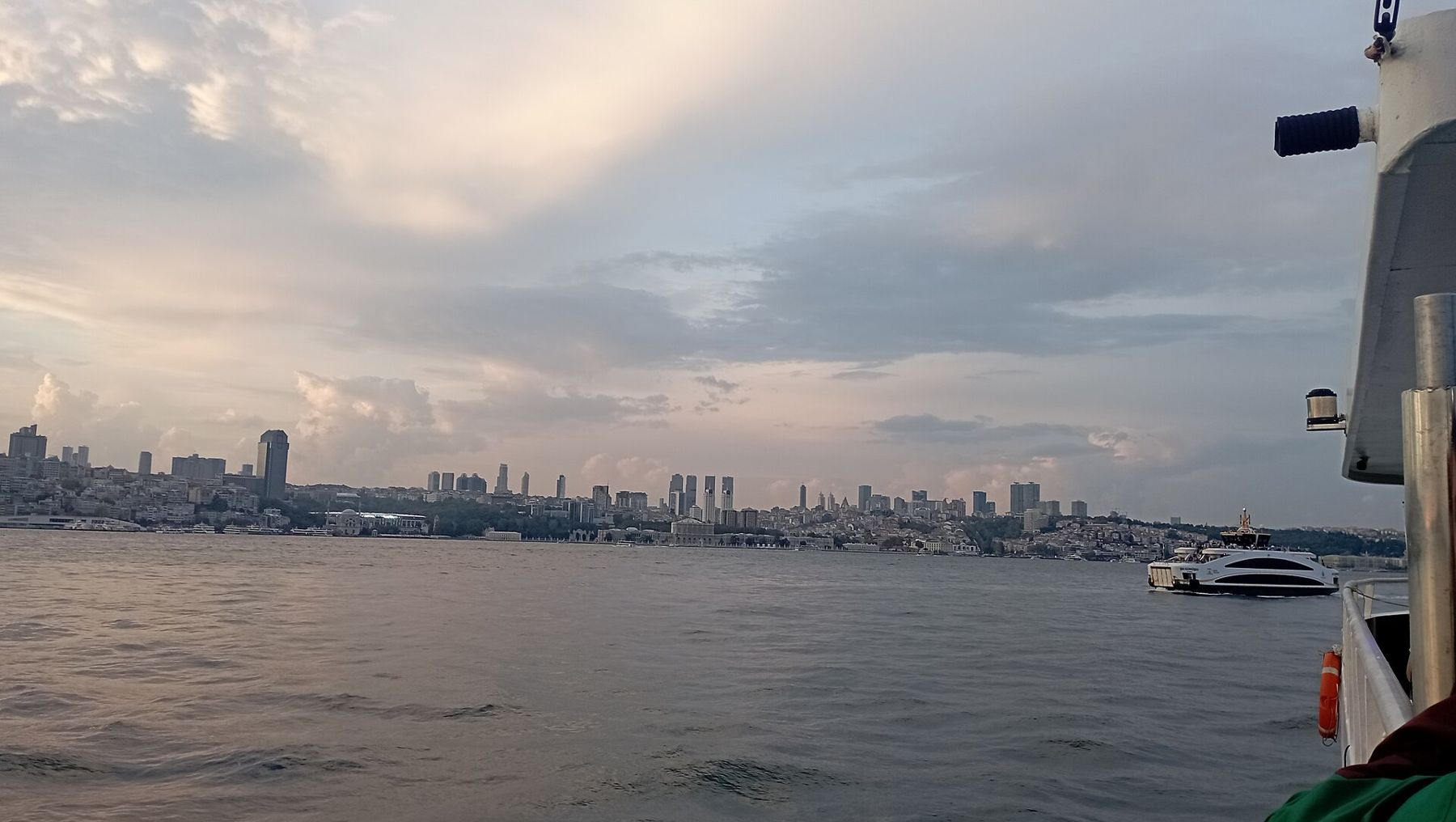
The Bosphorus is a sea lane about 30 kilometres long that happens to run through the middle of a city of many millions. A ship bound for the Black Sea threads it from south to north in roughly two hours, depending on speed and traffic, and for most of that time both shores are close enough to read: a ferry pier, a mosque courtyard, an angler on a sea wall. Going north, the European shore is on your left and the Asian shore on your right. Take the open deck on one side and cross over halfway.
Leaving Galata behind
Ships calling at Istanbul usually berth on the European side at Karaköy, below the Galata Tower, so the passage begins almost as soon as the lines are cast off. Look back as the ship swings out. The old city stands across the mouth of the Golden Horn on its own ridge: the domes and minarets of the imperial mosques, the walls and trees of the Topkapı Palace point, the low spread of Eminönü at the waterline. From the water it reads as one long skyline, which is how sailors arriving from the Sea of Marmara have seen it for centuries. The port day itself, and what fits ashore, is in our guide to a port day from Karaköy.
Ahead, the strait opens wide at first. On the left comes Dolmabahçe Palace, the long white façade built for the sultans in the middle of the nineteenth century, then the Çırağan palace and the waterfront of Beşiktaş and Ortaköy, where a small mosque in an ornate Baroque manner sits right at the water's edge below the first bridge. On the Asian side, Üsküdar and then the Beylerbeyi Palace slide by, pale stone against green hills.
Bridges, villas and the current
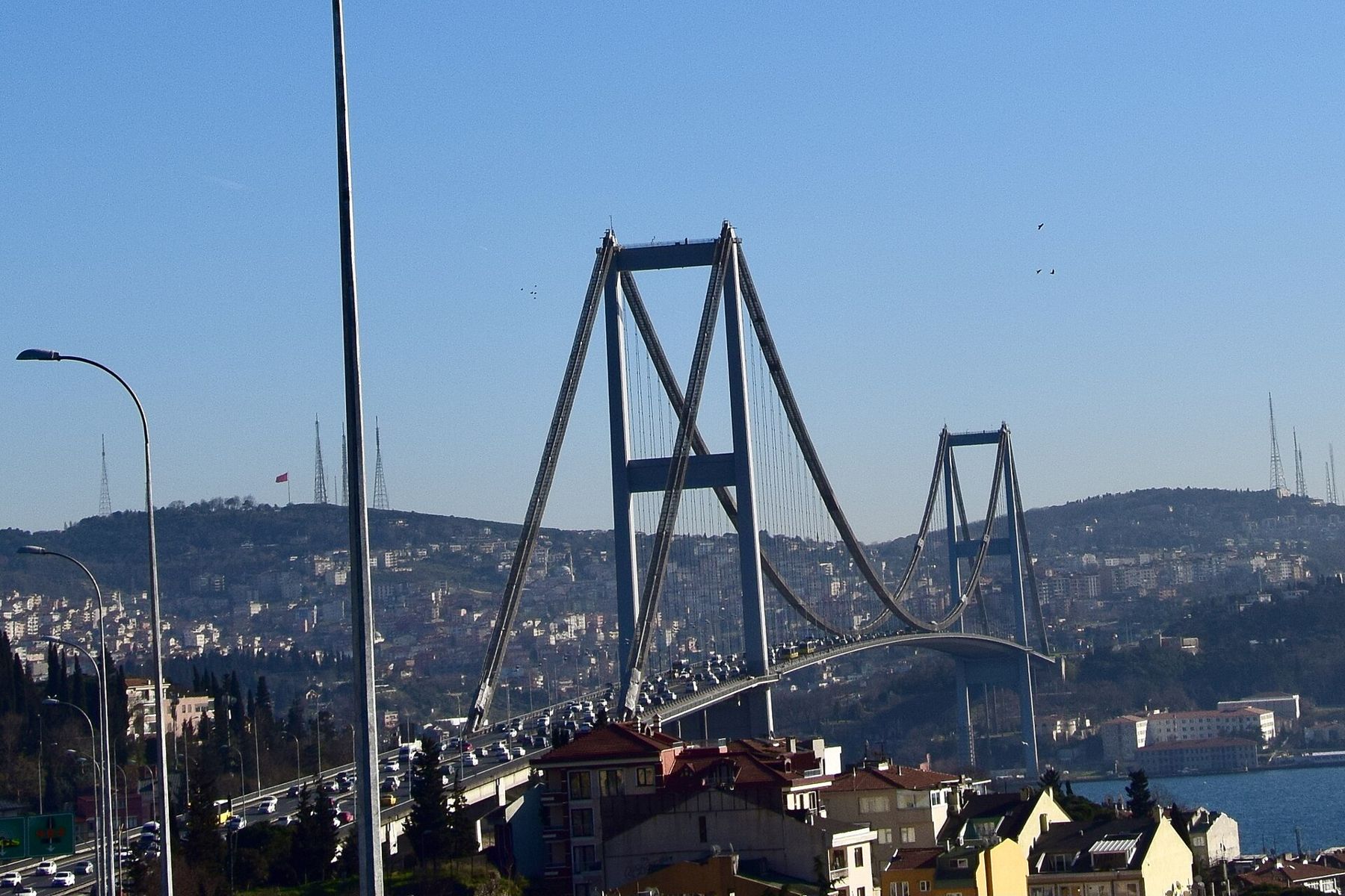
The first bridge, opened in 1973 and now called the 15 July Martyrs Bridge, crosses from Ortaköy to Beylerbeyi. From directly below, the deck is a thin dark line against the sky and the traffic noise reaches you a moment late. North of it the shores grow quieter and greener. This is the stretch of the yalı, the wooden waterside mansions of Ottoman families, some painted a deep oxblood red, some freshly restored, a few leaning tiredly towards the water. The bay of Bebek curves round on the left, Kandilli and its hill on the right.
Watch the water rather than the houses for a minute. The Bosphorus carries a surface current flowing south, from the less salty Black Sea down towards the Sea of Marmara, while a deeper, saltier current runs the other way underneath. At the bends the surface flow can be strong enough to make small boats work hard; the point at Arnavutköy is known for it, and you can sometimes see eddies and lines of foam where the water turns. A ship heading north is pushing against it, which is one reason the passage is unhurried. The two-layer exchange between the seas is explained in our story on the Black Sea itself.
The two fortresses at the narrows
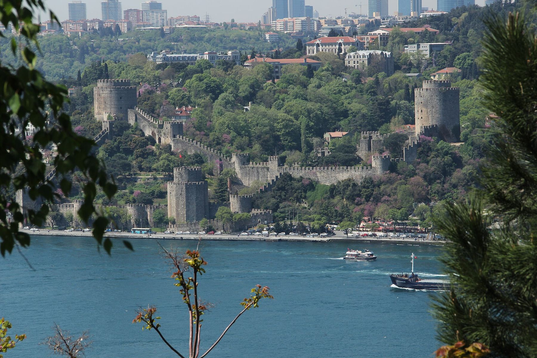
The strait is narrowest where the second bridge crosses, at well under a kilometre, and this is exactly where the two fortresses face each other. On the European side Rumeli Hisarı climbs the hill in three great towers linked by crenellated walls. Mehmed II had it built in a matter of months in 1452, the year before the Ottoman conquest of Constantinople, to control shipping through the strait. Across the water the smaller Anadolu Hisarı, older by about half a century, sits low beside the mouth of a stream. From a ship you see both at once, and the purpose of the place becomes obvious without a word of history.
The Fatih Sultan Mehmet Bridge, opened in 1988, passes overhead just north of the fortresses. After it the villages thin out: Emirgan and İstinye on the left, Kanlıca and Beykoz on the right, then long wooded slopes, small fishing harbours and moorings. Tankers and bulk carriers share the channel with you here, and the city ferries cut across between them with a confidence that can look alarming from above.
From a ship you see both at once, and the purpose of the place becomes obvious without a word of history.
Traffic rules, in general
The Bosphorus is one of the busiest waterways in the world, and it is run with care. The Montreux Convention of 1936 guarantees merchant ships free passage in peacetime, while the Turkish authorities manage the traffic itself: a vessel traffic service follows every movement, ships keep to separated lanes, and pilots are strongly recommended and widely used. Very large ships, or those carrying dangerous cargo, may pass while traffic runs in one direction only, and fog or strong currents can hold ships back. For a passenger this means the timing of your passage is not entirely your own ship's choice; departure may move, and the rail may be crowded or empty depending on the hour. Procedures change, so read this as background rather than a timetable.
The castle on the hill and the mouth of the strait
Towards the northern end the strait bends and widens again. On the Asian shore the fishing village of Anadolu Kavağı sits at the waterline, and on the hill above it stand the broken walls of Yoros Castle, a Byzantine fortress later held by the Genoese, its towers outlined against the sky. Rumeli Kavağı faces it on the European side. The local excursion boats turn round here, which tells you that this has long been thought of as the end of the city's Bosphorus.
The third bridge, the Yavuz Sultan Selim, opened in 2016, spans the gap between Garipçe and Poyrazköy high above the water. Beyond it the hills fall back and the swell changes underfoot. Rumeli Feneri, the lighthouse on the European headland, stands above a small village and an old fort; Anadolu Feneri answers it from the Asian side. Once both lights are behind you the water ahead is the open Black Sea, darker under a north wind, and the coast you have just left becomes a low line astern. For the months when that sea is usually calmest, see when to sail.
Where to stand
Going north, the European side holds Dolmabahçe, Rumeli Hisarı and Rumeli Feneri; the Asian side holds Beylerbeyi, Anadolu Hisarı and the castle above Anadolu Kavağı. The upper forward decks give the best view of the bridges approaching; the stern gives the best view of the old city falling away. Bring a layer even in summer, because the wind funnelled down the strait from the north turns cool in the evening, and binoculars for the castle walls and the lighthouses. Southbound ships see the same sequence in reverse and arrive with the old city ahead, which some passengers prefer.
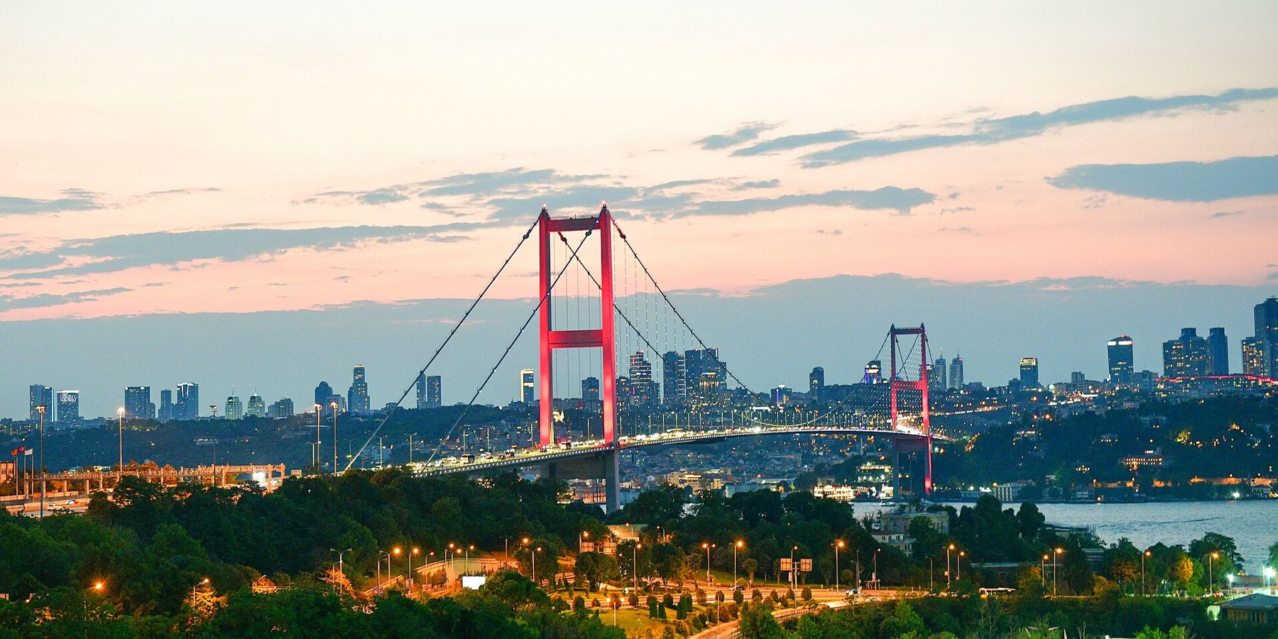
If your ship sails after dark, the bridges are lit, often in changing colours, and the palaces glow along the shore, but the fortresses and the northern hills fade into silhouette. A late-afternoon passage in early summer gives the longest light. Either way, the strait rewards an hour of standing still more than any shore excursion of the same length.
More ports on this coast: The Bosphorus gate.